From Factory Floor to Your Door in Indianapolis, IN
WindowDecor is a family-owned and operated company that was founded in 1993 by Daniel Leadingham. Daniel founded WindowDecor with the goal of providing his community with timely and cost effective window coverings by offering a “from factory floor to customer’s door” level of service.
We encourage you to take advantage of our knowledge and experience by scheduling a free consultation to allow us to help guide you through all the decisions you’ll be making to turn your house into a home. From project design to installation, from manufacturing to warranty, WindowDecor looks forward to helping you accomplish your vision. Come see why we are the most referred Window Covering company in Indianapolis, IN!
To see our entire product line, click here
We know blinds.
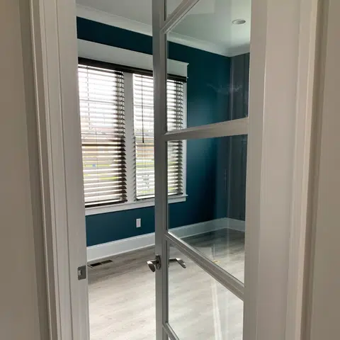
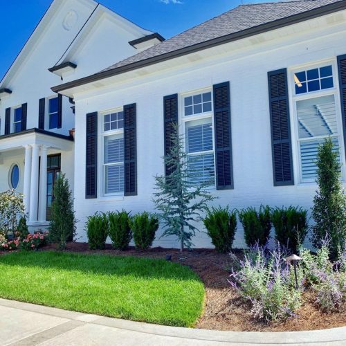
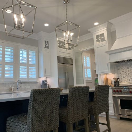
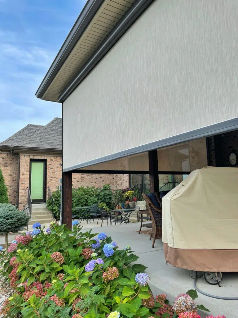
Plantation shutters, roman shades, interior blinds, exterior porch enclosures — if you have a window, we can help you make it look stunning.
We are an end-to-end shop. That means we:
- Consult to help you find the right window coverings.
- Design and produce these window coverings (nearly all are made in the USA)
- Professionally Install them directly in your home or commercial project.
You…
- Don’t need to pay for consultation or measurements
- Don’t need to work with a middleman
- Don’t need to hire an outside installer


Trusted in Indianapolis, IN for More Than 30 Years
Businesses and home owners trust us to cover their windows.


Working with WindowDecor
Feel confident in your decisions.
You can make all of these decisions about plantation shutters and exterior shades on your own. You really can. But do you want to?
For decades now our team has been helping customers in Indianapolis, IN find beautiful and creative new ways to enjoy their homes. We do this work day in and day out. We can help you save time and save money by finding what you want quickly. We would love to have you join us and see for yourself how good it feels to be working with a company that cares.
SIMPLICITY
You work with one company from start to finish. We design, manage, and install your window treatment project — inside and outside.
SAVE ON COSTS
With us bringing savings from the factory floor to your home you can be confident you’re getting the best deal!
OVER-THE-TOP SERVICE
See why our customers love us and why they come back time after time for the best quality, service, and products.
PROFESSIONAL PRODUCT
While you do save on costs, we don’t skimp on professionalism and a high-quality product. We stand behind our work. 100%.
Rated 5 Stars by Our Customers!
"I just want to take a few moments to say that from the first initial phone call to inquire about window treatments, to the ordering, and to the installation of window blinds in my new home, everyone involved in the process had great customer service!."
Rebecca Meza
"After checking out a few box stores we realized that we needed a professional opinion to make the best decision.Dan came out to the house and laid out the red carpet for us"
Joshua Gary
"Outstanding service and products from this company.From the initial consultation to the final installation, our experience was positive and professional."
Jennifer Appell
The WindowDecor team was a pleasure to work with, from start to finish. They proved to be much more affordable than other contractors and made every step of the process easy and seamless. As a family-owned and operated business, we were extra happy to support them. If you are looking for custom window treatments, look no further! They are top-notch.
Lindsay C.
We are WindowDecor.
Serving Indianapolis, IN and surrounding communities.
For three generations, WindowDecor has specialized in building and selling blinds and various window coverings. We work directly with you, the homeowners, to give you professional expertise without the added costs.
The name Indianapolis is derived from the state’s name, Indiana (meaning “Land of the Indians”, or simply “Indian Land”), and polis, the Greek word for “city.” Jeremiah Sullivan, justice of the Indiana Supreme Court, is credited with coining the name. Other names considered were Concord, Suwarrow, and Tecumseh.
In 1816, the year Indiana gained statehood, the U.S. Congress donated four sections of federal land to establish a permanent seat of state government. Two years later, under the Treaty of St. Mary’s (1818), the Delaware relinquished title to their tribal lands in central Indiana, agreeing to leave the area by 1821. This tract of land, which was called the New Purchase, included the site selected for the new state capital in 1820. The indigenous people of the land prior to systematic removal are the Miami Nation of Indiana (Miami Nation of Oklahoma) and Indianapolis makes up part of Cession 99; the primary treaty between the indigenous population and the United States was the Treaty of St. Mary’s (1818).
The availability of new federal lands for purchase in central Indiana attracted settlers, many of them descendants of families from northwestern Europe. Although many of these first European and American settlers were Protestants, a large proportion of the early Irish and German immigrants were Catholics. Few African Americans lived in central Indiana before 1840. The first European Americans to permanently settle in the area that became Indianapolis were either the McCormick or Pogue families. The McCormicks are generally considered to be the first permanent settlers; however, some historians believe George Pogue and family may have arrived first, on March 2, 1819, and settled in a log cabin along the creek that was later called Pogue’s Run. Other historians have argued as early as 1822 that John Wesley McCormick, his family, and employees became the area’s first European American settlers, settling near the White River in February 1820.
On January 11, 1820, the Indiana General Assembly authorized a committee to select a site in central Indiana for the new state capital. The state legislature approved the site, adopting the name Indianapolis on January 6, 1821. In April, Alexander Ralston and Elias Pym Fordham were appointed to survey and design a town plan for the new settlement. Indianapolis became a seat of county government on December 31, 1821, when Marion County, was established. A combined county and town government continued until 1832 when Indianapolis incorporated as a town. Indianapolis became an incorporated city effective March 30, 1847. Samuel Henderson, the city’s first mayor, led the new city government, which included a seven-member city council. In 1853, voters approved a new city charter that provided for an elected mayor and a fourteen-member city council. The city charter continued to be revised as Indianapolis expanded. Effective January 1, 1825, the seat of state government moved to Indianapolis from Corydon, Indiana. In addition to state government offices, a U.S. district court was established at Indianapolis in 1825.
Growth occurred with the opening of the National Road through the town in 1827, the first major federally funded highway in the United States. A small segment of the ultimately failed Indiana Central Canal was opened in 1839. The first railroad to serve Indianapolis, the Jeffersonville, Madison and Indianapolis Railroad, began operation in 1847, and subsequent railroad connections fostered growth. Indianapolis Union Station was the first of its kind in the world when it opened in 1853.
During the American Civil War, Indianapolis was mostly loyal to the Union cause. Governor Oliver P. Morton, a major supporter of President Abraham Lincoln, quickly made Indianapolis a rallying place for Union army troops. On February 11, 1861, President-elect Lincoln arrived in the city, en route to Washington, D.C. for his presidential inauguration, marking the first visit from a president-elect in the city’s history. On April 16, 1861, the first orders were issued to form Indiana’s first regiments and establish Indianapolis as a headquarters for the state’s volunteer soldiers. Within a week, more than 12,000 recruits signed up to fight for the Union.
Indianapolis became a major logistics hub during the war, establishing the city as a crucial military base. Between 1860 and 1870, the city’s population more than doubled. An estimated 4,000 men from Indianapolis served in 39 regiments, and an estimated 700 died during the war. On May 20, 1863, Union soldiers attempted to disrupt a statewide Democratic convention at Indianapolis, forcing the proceedings to be adjourned, sarcastically referred to as the Battle of Pogue’s Run. Fear turned to panic in July 1863, during Morgan’s Raid into southern Indiana, but Confederate forces turned east toward Ohio, never reaching Indianapolis. On April 30, 1865, Lincoln’s funeral train made a stop at Indianapolis, where an estimated crowd of more than 100,000 people passed the assassinated president’s bier at the Indiana Statehouse.
Following the Civil War—and in the wake of the Second Industrial Revolution—Indianapolis experienced tremendous growth and prosperity. In 1880, Indianapolis was the world’s third largest pork packing city, after Chicago and Cincinnati, and the second largest railroad center in the United States by 1888. By 1890, the city’s population surpassed 100,000. Some of the city’s most notable businesses were founded during this period of growth and innovation, including L. S. Ayres (1872), Eli Lilly and Company (1876), Madam C. J. Walker Manufacturing Company (1910), and Allison Transmission (1915). Once home to 60 automakers, Indianapolis rivaled Detroit as a center of automobile manufacturing. The city was an early focus of labor organization. The Indianapolis Street Car Strike of 1913 and subsequent police mutiny and riots led to the creation of the state’s earliest labor-protection laws, including a minimum wage, regular work weeks, and improved working conditions. The International Typographical Union and United Mine Workers of America were among several influential labor unions based in the city.
Some of the city’s most prominent architectural features and best known historical events date from the turn of the 20th century. The Soldiers’ and Sailors’ Monument, dedicated on May 15, 1902, would later become the city’s unofficial symbol. Ray Harroun won the inaugural running of the Indianapolis 500, held May 30, 1911, at Indianapolis Motor Speedway. Indianapolis was one of the hardest hit cities in the Great Flood of 1913, resulting in five known deaths and the displacement of 7,000 families.
As a stop on the Underground Railroad, Indianapolis had one of the largest black populations in the Northern States, until the Great Migration. Led by D. C. Stephenson, the Indiana Klan became the most powerful political and social organization in Indianapolis from 1921 through 1928, controlling City Council and the Board of School Commissioners, among others. At its height, more than 40% of native-born white males in Indianapolis claimed membership in the Klan. While campaigning in the city in 1968, Robert F. Kennedy delivered one of the most lauded speeches in 20th century American history, following the assassination of civil rights leader Martin Luther King Jr. As in most U.S. cities during the Civil Rights Movement, the city experienced strained race relations. A 1971 federal court decision forcing Indianapolis Public Schools to implement desegregation busing proved controversial.
Under the mayoral administration of Richard Lugar, the city and county governments restructured, consolidating most public services into a new entity called Unigov. The plan removed bureaucratic redundancies, captured increasingly suburbanizing tax revenue, and created a Republican political machine that dominated Indianapolis politics until the 2000s. Unigov went into effect on January 1, 1970, increasing the city’s land area by 308.2 square miles (798 km2) and population by 268,366 people. It was the first major city-county consolidation to occur in the United States without a referendum since the creation of the City of Greater New York in 1898.
Amid the changes in government and growth, the city invested in an aggressive strategy to brand Indianapolis as a sports tourism destination, known as the Indianapolis Project. Under the administration of the city’s longest-serving mayor, William Hudnut (1976–1992), millions of dollars were poured into sport facilities and public relations campaigns as part of an economic development strategy. The strategy was successful in landing the U.S. Olympic Festival in 1983, securing the 1984 relocation of the NFL Baltimore Colts, and hosting the 1987 Pan American Games.
Economic development initiatives focused on revitalizing the city’s downtown continued in the 1990s under the mayoral administration of Stephen Goldsmith. During this period, a number of cultural amenities were completed at White River State Park, the Canal Walk continued development, Circle Centre Mall was completed, and new sports venues (Victory Field and Bankers Life Fieldhouse) were opened. In 1999, several cultural districts were designated to capitalize on cultural assets within historically significant neighborhoods unique to the city’s heritage as a means to promote continued economic development.
During the 2000s, the city invested heavily in infrastructure projects, including two of the largest building projects in the city’s history: the $1.1 billion Indianapolis International Airport Colonel H. Weir Cook Terminal and $720 million Lucas Oil Stadium, both opened in 2008. A $275 million expansion of the Indiana Convention Center was completed in 2011. Construction began that year on DigIndy, a $1.9 billion project to correct the city’s combined sewer overflows by 2025. Rapid transit was reintroduced to Indianapolis with the opening of IndyGo’s $96 million Red Line bus rapid transit project in 2019.
Indianapolis is in the East North Central region of the Midwestern United States, in central Indiana. According to the U.S. Census Bureau, the Indianapolis (balance) encompasses a total area of 368.2 square miles (954 km2), of which 361.5 square miles (936 km2) is land and 6.7 square miles (17 km2) is water. The consolidated city boundaries are coterminous with Marion County, with the exception of the autonomous municipalities of Beech Grove, Lawrence, Southport, and Speedway. Indianapolis is the 16th largest city by land area in the U.S.
Indianapolis is within the Tipton Till Plain, a flat to gently sloping terrain underlain by glacial deposits known as till. The lowest point in the city is about 650 feet (198 m) above mean sea level, with the highest natural elevation at about 900 feet (274 m) above sea level. Few hills or short ridges, known as kames, rise about 100 feet (30 m) to 130 feet (40 m) above the surrounding terrain. The city lies just north of the Indiana Uplands, a region characterized by rolling hills and high limestone content. The city is also within the EPA’s Eastern Corn Belt Plains ecoregion, an area of the U.S. known for its fertile agricultural land.
Topographic relief slopes gently toward the White River and its two primary tributaries, Fall and Eagle creeks. In total, there are about 35 streams in the city, including Indian Creek and Pogue’s Run. Major bodies of water include Indian Lake, Geist Reservoir, and Eagle Creek Reservoir.
Indianapolis is a planned city. On January 11, 1820, the Indiana General Assembly authorized a committee to select a site in central Indiana for the new state capital, appointing Alexander Ralston and Elias Pym Fordham to survey and design a town plan for Indianapolis. Ralston had been a surveyor for the French architect Pierre L’Enfant, assisting him with the plan for Washington, D.C. Ralston’s original plan for Indianapolis called for a town of 1 square mile (2.6 km2), near the confluence of the White River and Fall Creek.
The plan, known as the Mile Square, is bounded by East, West, North, and South streets, centered on a traffic circle, called Monument Circle (originally Governor’s Circle), from which Indianapolis’s “Circle City” nickname originated. Four diagonal streets radiated a block from Monument Circle: Massachusetts, Virginia, Kentucky, and Indiana avenues. The city’s address numbering system begins at the intersection of Washington and Meridian streets. Before its submersion into a sanitary tunnel, Pogue’s Run was included into the plan, disrupting the rectilinear street grid to the southeast.
Noted as one of the finest examples of the City Beautiful movement design in the United States, the Indiana World War Memorial Plaza Historic District began construction in 1921 in downtown Indianapolis. The district, a National Historic Landmark, encompasses several examples of neoclassical architecture, including the American Legion, Central Library, and Birch Bayh Federal Building and United States Courthouse. The district is also home to several sculptures and memorials, Depew Memorial Fountain, and open space, hosting many annual civic events.
After completion of the Soldiers’ and Sailors’ Monument, an ordinance was passed in 1905 restricting building heights on the traffic circle to 86 ft (26 m) to protect views of the 284 ft (87 m) monument. The ordinance was revised in 1922, permitting buildings to rise to 108 ft (33 m), with an additional 42 ft (13 m) allowable with a series of setbacks. A citywide height restriction ordinance was instituted in 1912, barring structures over 200 ft (61 m). Completed in 1962, the City-County Building was the first skyscraper in the city, surpassing the Soldiers’ and Sailors’ Monument in height by nearly 100 ft (30 m). A building boom, lasting from 1982 to 1990, saw the construction of six of the city’s ten tallest buildings. The tallest is Salesforce Tower, completed in 1990 at 811 ft (247 m). Indiana limestone is the signature building material in Indianapolis, widely included in the city’s many monuments, churches, academic, government, and civic buildings.
Compared with similar-sized American cities, Indianapolis is unique in that it contains some 200 farms covering thousands of acres of agricultural land within its municipal boundaries. Equestrian farms and corn and soybean fields interspersed with suburban development are commonplace on the city’s periphery, especially in Franklin Township. The stark contrast between Indianapolis’s urban neighborhoods and rural villages is a result of the 1970 city-county consolidation, which expanded the city’s incorporated boundary to be coterminous with Marion County.
The city is divided into 99 community areas for statistical purposes, though many smaller neighborhoods exist within them. Indianapolis’s neighborhoods are often difficult to define because the city lacks historical ethnic divisions, as in Chicago, or physical boundaries, seen in Pittsburgh and Cincinnati. Instead, most neighborhoods are subtle in their distinctions. The Indianapolis Historic Preservation Commission recognizes several neighborhoods as historic districts, including Central Court, Chatham Arch, Golden Hill, Herron-Morton Place, Lockerbie Square, Old Northside, Old Southside and Oliver Johnson’s Woods. Expansion of the interurban system at the turn of the 20th century facilitated growth of several streetcar suburbs, including Broad Ripple, Irvington, University Heights, and Woodruff Place.
The post–World War II economic expansion and subsequent suburbanization had a profound impact on the physical development of the city’s neighborhoods. From 1950 to 1970, 97,000 housing units were built in Marion County. Most of this new construction occurred outside Center Township, expediting out-migration from the city’s urban neighborhoods to suburban areas, such as Castleton, Eagledale, and Nora. Between 1950 and 1990, over 155,000 residents left Center Township, resulting in urban blight and disinvestment. Since the 2000s, Downtown Indianapolis and surrounding neighborhoods have seen increased reinvestment attributed to nationwide demographic trends, driven by empty nesters and millennials. By 2020, Downtown is projected to have 30,000 residential units, compared to 18,300 in 2010.
Renewed interest in urban living has been met with some dispute regarding gentrification and affordable housing. According to a Center for Community Progress report, neighborhoods like Cottage Home and Fall Creek Place have experienced measurable gentrification since 2000. The North Meridian Street Historic District is among the most affluent urban neighborhoods in the U.S., with a mean household income of $102,599 in 2017.
Indianapolis has a humid continental climate (Köppen climate classification Dfa), but can be considered a borderline humid subtropical climate (Köppen: Cfa) using the −3 °C (27 °F) isotherm. It experiences four distinct seasons. The city is in USDA hardiness zone 6a.
Typically, summers are hot, humid and wet. Winters are generally cold with moderate snowfall. The July daily average temperature is 75.4 °F (24.1 °C). High temperatures reach or exceed 90 °F (32 °C) an average of 18 days each year, and occasionally exceed 95 °F (35 °C). Spring and autumn are usually pleasant, if at times unpredictable; midday temperature drops exceeding 30 °F or 17 °C are common during March and April, and instances of very warm days (80 °F or 27 °C) followed within 36 hours by snowfall are not unusual during these months. Winters are cold, with an average January temperature of 28.1 °F (−2.2 °C). Temperatures dip to 0 °F (−18 °C) or below an average of 4.7 nights per year.
The rainiest months occur in the spring and summer, with slightly higher averages during May, June, and July. May is typically the wettest, with an average of 5.05 inches (12.8 cm) of precipitation. Most rain is derived from thunderstorm activity; there is no distinct dry season, although occasional droughts occur. Severe weather is not uncommon, particularly in the spring and summer months; the city experiences an average of 20 thunderstorm days annually.
The city’s average annual precipitation is 42.4 inches (108 cm), with snowfall averaging 25.9 inches (66 cm) per season. Official temperature extremes range from 106 °F (41 °C), set on July 14, 1936, to −27 °F (−33 °C), set on January 19, 1994.
